Peitlerkofel Mountain Tour

Marcus
| 24-09-2026
 · Travel team
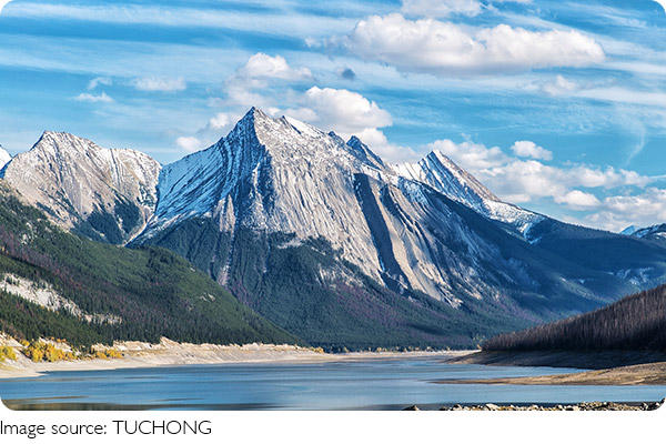
Peitlerkofel is one of the striking peaks of the Dolomites, rising to about 2,874 meters above the Würzjoch pass.
The mountain sits within the Puez-Odle Nature Park and combines open alpine meadows, rocky slopes, and expansive views across the surrounding peaks. It is a rewarding climb, but the final section requires confidence on exposed terrain.
Getting to the Starting Point
The standard route begins at Würzjoch, also known as Passo delle Erbe, at roughly 2,000 meters. By car, the pass can be reached from Brixen through Lüsen or via the Villnöss Valley. There is a paid parking area near the pass. Travelers without a car can use regional buses. One option is Bus 330 to St. Peter, followed by Bus 339 to Würzjoch. Bus fares depend on the starting point, but a local journey commonly costs around $5 to $15.
Best Time to Visit
The most suitable hiking period is generally late spring through early autumn, when snow conditions are more favorable. July and August usually offer the longest hiking days, although they can also bring more visitors. September can be particularly attractive for cooler temperatures and autumn scenery. Always check current mountain conditions before leaving, as snow can remain at higher elevations even outside winter.
Peitlerkofel
Entrance Fees and Hiking Costs
There is no entrance fee for hiking to Peitlerkofel or entering the surrounding nature park. The main transport expense is parking or public transportation. A guided mountain excursion can cost approximately $80 to $160 per person, depending on the guide, group size, and route.
The Route to Peitlerkofel
From Würzjoch, follow trail 8A toward the alpine meadows and the Munt de Fornella area. The path continues toward Peitlerscharte, where the route becomes steeper. The summit route is approximately 5.8 km one way, with around 943 meters of elevation gain and about 3 hours and 10 minutes for the ascent route under the published itinerary. The highest point is about 2,874 meters.
Near the ridge between the Kleine and Große Peitlerkofel, the final section includes a short exposed passage protected by steel cables. Appropriate via ferrata equipment is recommended for this section.
An Easier Alternative
Travelers who do not want to tackle the cable-protected summit section can choose the Kleine Peitlerkofel, which reaches approximately 2,813 meters. The route branches off below the main summit access and avoids the exposed via ferrata section. Another option is the Peitlerkofel circular route. This takes about 4 hours, covers approximately 12.9 km, and has around 639 meters of elevation gain. It provides excellent mountain scenery without requiring the main summit climb.
What to Bring
Sturdy hiking boots are essential because the terrain changes from forest paths and grassy meadows to rocky mountain ground. Pack plenty of water, snacks, sun protection, a waterproof jacket, and an extra warm layer. For the summit route, hikers should carry suitable via ferrata equipment, including a harness, helmet, and energy-absorbing lanyard. Do not attempt the exposed section during storms, strong winds, or icy conditions.
Food and Accommodation
Mountain huts around Würzjoch provide convenient places for refreshments when they are operating. A simple meal or snack generally costs around $12 to $25. For overnight stays, guesthouses and mountain-area accommodation typically range from $80 to $150 per night for simpler rooms, while comfortable hotels can reach $150 to $250 or more during the busy summer period.
Safety and Planning
Although the lower trail sections are manageable for experienced hikers, the summit should not be treated as an ordinary walking trail. The elevation gain is significant, and the cable-protected section requires good balance and confidence. Start early, allow plenty of time for the return journey, and keep an eye on changing weather. If conditions deteriorate, turning back is safer than continuing toward the summit.
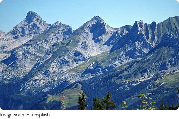
Peitlerkofel offers a memorable combination of alpine meadows, rugged rock formations, and sweeping Dolomite views. The main summit is best suited to experienced hikers equipped for the exposed final section, while the lower summit and circular trail provide alternatives for a less demanding day.