Penang Crossing

Tessa
| 29-09-2026
 · Travel team
Hi, Lykkers! The Second Penang Bridge, officially known as the Sultan Abdul Halim Mu'adzam Shah Bridge, is a major road connection between Penang Island and Seberang Perai in Malaysia.
The bridge connects Batu Maung on the island with Batu Kawan on the mainland and provides an important route for traffic between the two areas.
A Major Coastal Connection
The bridge is located in the southern part of Penang and provides an additional road connection between the island and mainland. Its route was developed to support increasing traffic between the two parts of Penang and to improve connectivity around the southern areas of the state.
The bridge forms part of the road network serving Batu Maung, Batu Kawan, and surrounding areas. Its location also provides access toward Penang International Airport and other destinations in southern Penang.
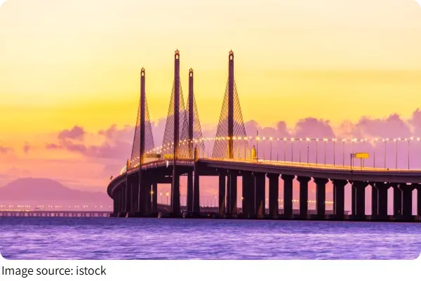
24 Kilometres Across Penang
The Second Penang Bridge has an overall length of 24 kilometres, including its bridge and road sections. According to the Malaysian Highway Authority, approximately 17 kilometres of the route crosses the sea, while the remaining section consists of road approaches on land.
The bridge was officially opened on 3 January 2014. It was named the Sultan Abdul Halim Mu'adzam Shah Bridge in honour of the former Yang di-Pertuan Agong.
Penang Second Bridge
Connecting Batu Maung and Batu Kawan
The Second Penang Bridge links Batu Maung on Penang Island with Batu Kawan on the mainland. This connection provides an alternative route to the first Penang Bridge and supports travel between southern Penang and Seberang Perai.
For visitors travelling by road, the bridge can be part of a journey between Penang Island and mainland destinations. Batu Kawan has also developed into an important area for commercial, residential, and industrial activities.
Views Across the Sea
The bridge crosses the southern part of the Penang Strait, offering views of the surrounding waters and coastal landscape while travelling across it. Its long structure is also visible from parts of Batu Maung and Batu Kawan.
Although the Second Penang Bridge is primarily transportation infrastructure rather than a conventional sightseeing attraction, its large scale and location over the sea make it a recognizable part of Penang's modern landscape.
How to Use the Bridge
The Second Penang Bridge is designed for road traffic and connects directly with the road networks on both sides. Travellers approaching from Penang Island can access the bridge through Batu Maung, while those coming from the mainland can reach it through Batu Kawan.
As a highway connection, visitors should use the bridge as part of their journey rather than treating it as a pedestrian tourist attraction.
Toll and Travel Information
The Second Penang Bridge operates as an open toll system. Toll collection began in April 2014, with the toll charged for travel from the mainland toward the island.
There is no separate tourist entrance fee because the bridge is a highway. The applicable toll depends on the vehicle category and current regulations, so travellers should check the latest toll information before making a journey.
Tips for Visitors
The Second Penang Bridge is best experienced as part of a road trip between Penang Island and Seberang Perai. Drivers should follow traffic regulations and avoid stopping on the bridge except in designated areas.
Travellers who want to see the bridge as a landmark can view it from suitable locations around Batu Maung or Batu Kawan rather than stopping along the highway.
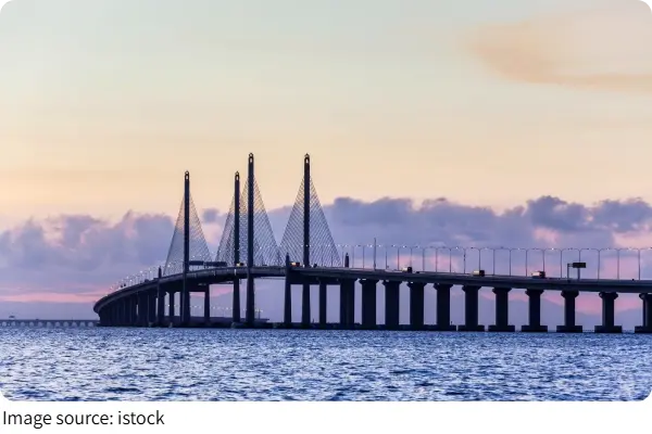
A Modern Penang Landmark
The Second Penang Bridge is an important part of Penang's transportation network, connecting Batu Maung and Batu Kawan across the sea. With its 24-kilometre route and distinctive coastal setting, the bridge has become a notable feature of modern Penang.